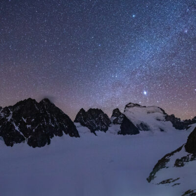
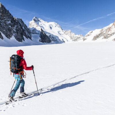
How to prepareHis night in a refuge and his hikes in the mountains?
Are you going to a refuge and you want to prepare your outing so that everything goes smoothly?
You’ve come to the right place!
The Mountain National Parks and the FFCAM give you their “tips and tricks” to prepare your mountain hike:
Prepare well and equip yourself #1
Going to the mountains is never trivial and requires appropriate equipment and preparation. The same goes for spending the night in a refuge… which is not a hotel!
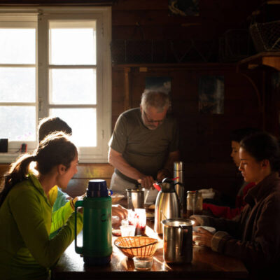
Living Together #2
A shelter is a place of collective reception. In exchange for a warm welcome and a friendly atmosphere, a few specific rules must be respected!
Limit your environmental impact #3
Shelters are by nature built on isolated sites where water and energy sources are limited and where garbage trucks do not pass…
Respecting the rules to preserve nature #4
The mountains, and more particularly the heart of national parks, are fragile spaces, where everyone has a role to play!
Plan your routes online
Discover our website dedicated to hiking in the Écrins and prepare your next outing as well as possible!
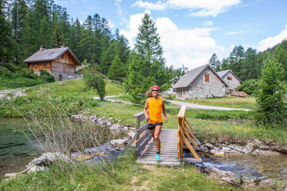
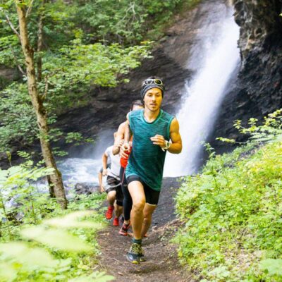
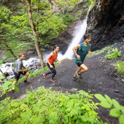
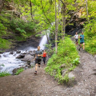
Come and let off steam on our 10 most beautiful trail routes in the heart of the Pays des Ecrins.
La Roche-de-Rame,circuit of the lakes
A superb climb in the woods, with a few steep slopes to get the cardio going, then the view that opens up on the Queyras and the Tête de Vautisse as you approach the Peyron pass. Finally arrived at the top, you enjoy a little, breathe a lot, enjoy the view of the Pic du Béal Traversier behind you, then you look a little towards the descent. And finally we discover the real goal of this race, Lake Escur and then Lake Ascension, which we can enjoy at leisure during the descent, very gentle and regular.
The VigneauxThe Cross of La Salcette
Leaving Les Vigneaux and the Vallouise valley, you gradually rise above two valleys, one eye towards Briançon, the other towards Vallouise, while you reach the hamlet of Bouchier in which you would like to stop as the atmosphere is so mild. We set off again in the woods following a regular slope, until the arrival under the pincers of the Montbrison, where the slope becomes steeper, the last efforts before arriving at the Croix de la Salcette, from where we dominate almost everything and from where the view is magical!
The VigneauxThe tour of Montbrison
Col de la Trancoulette and Col de la Vallouise are on the programme of this difficult but magnificent trail that takes you around the emblematic Montbrison. The long climb to the Col de la Trancoulette is rich and varied, we gradually leave Les Vigneaux and Bouchier to go deeper into the Montbrison massif. Then we come out of it by climbing towards the Col de la Vallouise, where the Pelvoux and the Blanche reveal themselves a little more with each stride. The end is a race downhill to Les Vigneaux.
FreissinièresMonsieur’s walk
Trail running has always fascinated you but you are afraid to take the plunge, fearing climbs that are too steep or descents that are too arduous? Fortunately, the Freissinières valley and the aptly named Monsieu r balladare there for you, with a start at the bottom of the valley, then a gentle climb on an excellent forest path. The descent is rolling and very pleasant, before reaching the bottom of the valley, where you can enjoy an exceptionalsetting, almost effortlessly!
The Col de la Pousterle
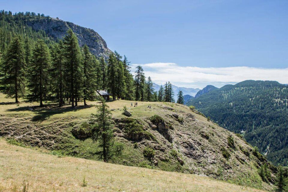
A climb to a pass is the assurance of a discovery that will occur, at some point, a landscape that opens up after a final bend. The climb to the Col de la Pousterle is all that, and even a little better. Because the landscapes are countless here, you almost forget that you are running and that the slope is going up, so captivating is the scenery. The arrival at the top could not be more magical, a wooded plateau,splendid lights… one would almost hesitate to go down!
VallouiseTrailounet
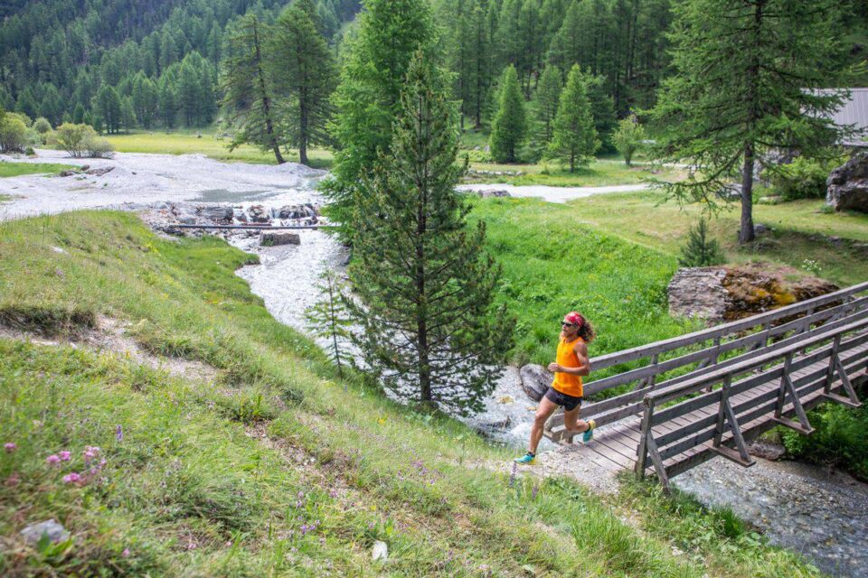
At the start of this trail, if you go up, it is only to take a step back from the Vallouise valley, to be able to observe the village of Vallouise and the summits of the Bans more freely. By joining the balcony trail, you can taste the joys of the thorn-covered trail trails that make the stride so fluid and the support so flexible. The return is along the Gyronde on a flat path that calls for the final sprint.
The Lauzet Circuit
Are you a trail runner looking to improve your running technique ? The Circuit du Lauzet is for you! Forest track, torrent crossing, grassy track, forest crossing, steep ascent and descent in small switchbacks. This quiet itinerary explores two small valleys, with the typical chalets of Lauzet as a highlight.
Puy Aillaud
The start along the Gyr is a perfect warm-up, from Vallouise to Pelvoux, before attacking the climb to Puy Aillaud. The climb is gentle and regular, and leaves time to admire the hamlets of Pelvoux below as well as the valley of Chambran, dominated by the pyramid of the Cucumelle. The arrival at the summit is in a flowery meadow, before reaching the hamlet of Puy Aillaud, then descending to Vallouise through the forest, looking towards the Queyras.
The DurancePink Marble Circuit
A very easy loop to climb above the Durance, between the pine forest and the lavender, on a forest track in very good condition. The unobstructed view allows you to admire the singular lake of the Roche de Rame, along a balcony crossing to the south, before returning to the Roche de Rame. For sure, the mere thought of soaking your tired legs in the clear water should make you speed up at the end.
VallouiseOndinette
If the slope scares you, if the sun worries you, then take your shoes anyway, and follow the forest track along the Onde, on a calm and quiet route. Perfect for initiation or recovery sessions, the Ondinette is an opportunity for you to close your eyes (not for too long while running) to enjoy the sound of the waterfalls and the torrent, and to feel the larches around you.
Did you like the experience and would you like to discover all our other trai l routes? Do you want to try the adventure of a 3-day trail around the Pays des Ecrins? Visit our Geotrek portal for a maximum of exceptional routes !
Plan your routes online
Discover our website dedicated to hiking in the Écrins and prepare your next outing as well as possible!
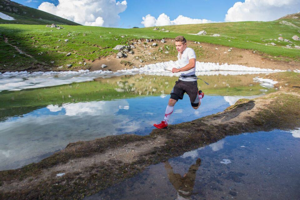
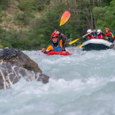
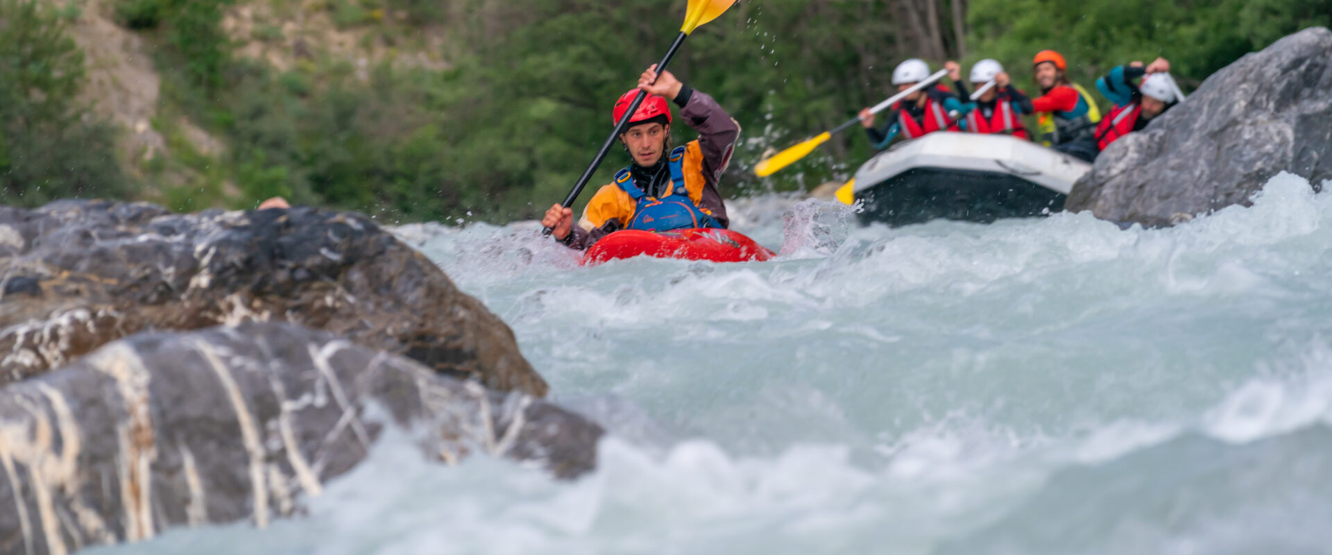
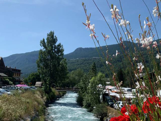
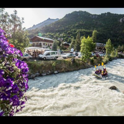
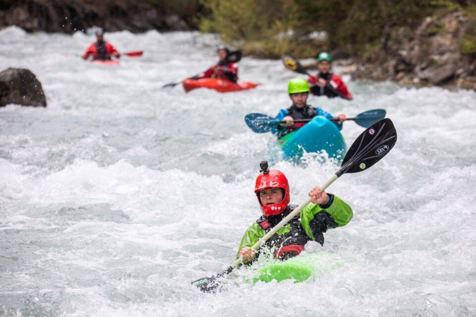
In the heart of the Alps, the Pays des Écrins is home to spectacular rivers that will delight both white water enthusiasts and nature lovers. This top 10 invites you to discover the most beautiful of them, between wild torrents, deep gorges and preserved alpine landscapes.
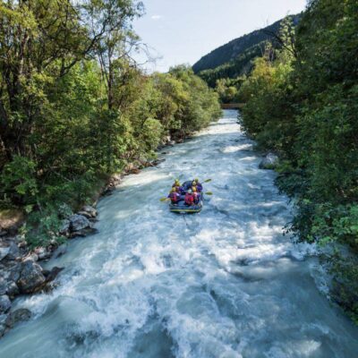
La Gyonde (Part 1): from Vallouise to Les Vigneaux
At the junction of the Onde and the Gyr, the Gyronde is created and its waters trace the Vallouise valley. A course classified III/IV, marked by a few rapids at the beginning. The Blanche behind and the Queyras in the line of sight offer a rich panorama. However, beware of the pumping station at the exit of Vallouise.
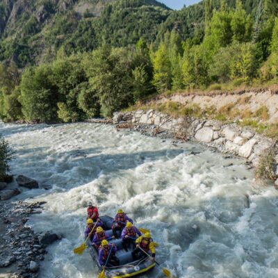
La Gyronde (Part 2): from Vigneaux to Argentière
The second part of the Gyronde is more sporty and rushes into the gorges under the Bâtie des Vigneaux. Classified III/IV, this section is more isolated, especially in the gorges, before arriving in the Argentière basin. The view opens up quickly when you arrive at the Argentière, on the Durance valley, bordered between the Queyras and the Écrins.
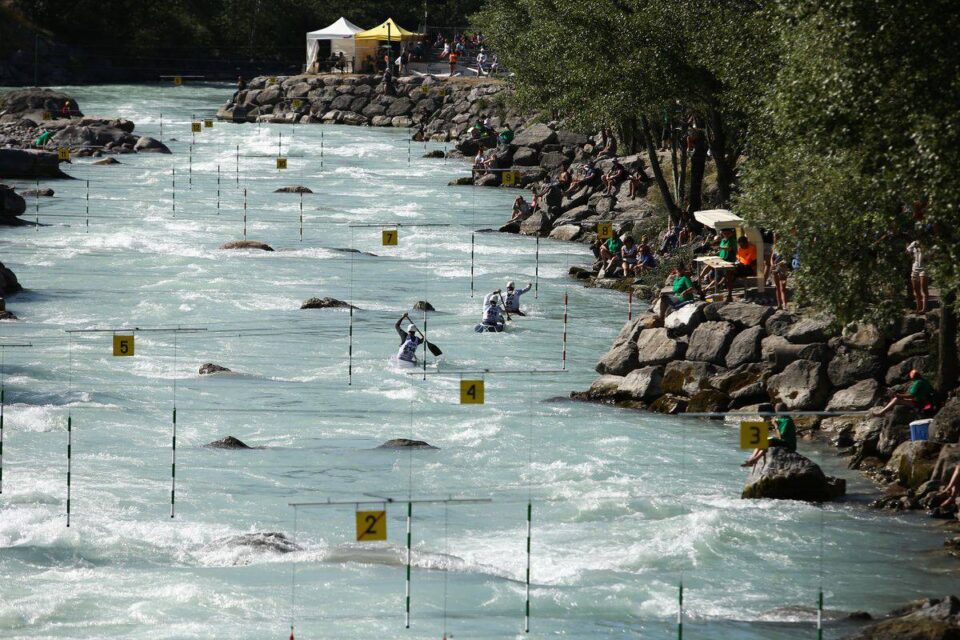
L’argentière-la-BesséeThe whitewater stadium
This stadium, located on the natural course of the Durance and artificially rocked, is a dream place for experienced kayakers. Usable from spring to autumn, this stadium offers a privileged setting for training and improvement.
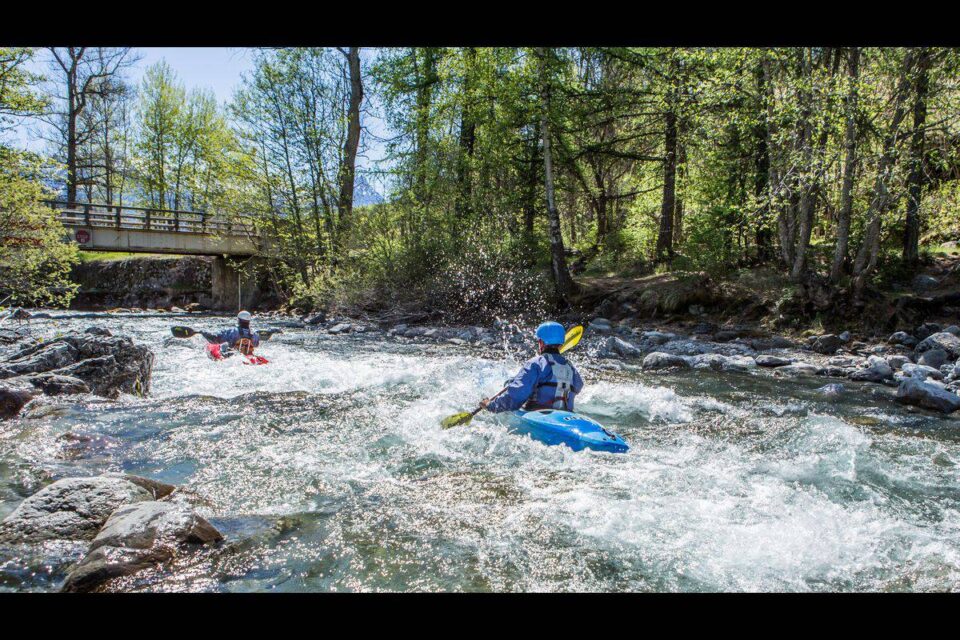
Le Gyr: from Pelvoux to Vallouise
An extremely sporty and demandingriver, which will delight the most adventurous among you. Rated IV/V, the Gyr is everything a high mountain river should be: fast, powerful, cold and without pauses, but it is terribly satisfying to get to the end! Mandatory descent on arrival in Vallouise.
The Durance: from Argentière to La Roche-de-Rame
This portion of the emblematic Durance is a perfect initiation course for anyone wishing to learn about whitewater. This course complements the practice in the Argentière stadium very well, on a course classified III, marked by a single rapid at the entrance to La Roche-de-Rame.
The Durance: from La Roche-de-Rame to Saint-Clément-sur-Durance
The journey on the Durance continues on this section made for beginners or for a quiet and peacefulwalk, with family or friends. Without any major risk, this classified II route is an opportunity to observe the Durance valley, arriving at the Serre-Ponçon lake.
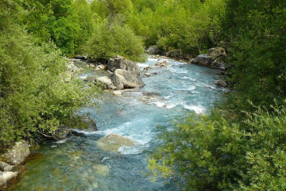
L’Onde: from Entre-Aigues to Vallouise
In the protected glacial valley that leads from Entre-Aigues to Vallouise, the Onde flows, cold and tumultuous. Easy to access, this river , classified III/IV, with a few steep rapids , does not present any particular danger and offers a splendid view of the Tête d’Amont. The finish is on the outskirts of Vallouise at the Gérondoine bridge.
La Byaisse (Part 1): from the Pont des Oules to Freissinières
A little gem hidden at the bottom of the Freissinières valley, the Biaysse is an exceptional river, narrow and technical, quite intimate. The start is a heavenly place that you would almost find difficult to leave, if the call of the river was not so strong. This long course, between 2h30 and 4h depending on the knowledge of the route, is classified IV, is marked by many rapid and small falls that will delight the most seasoned among you.
La Byaisse (Part 2): from Freissinières to Pallon
Much shorter than the first portion, this route lasts only about twenty minutes and is perfectly suited to the discovery of white water in the high mountains. The route, classified II/III , is done quietly with the Queyras in focus, in a superb alpine valley!
The Durance: from Prelles to Argentière
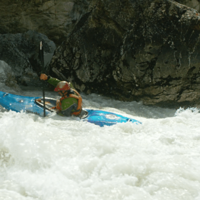
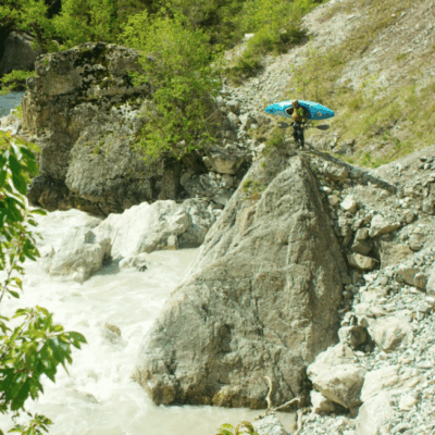
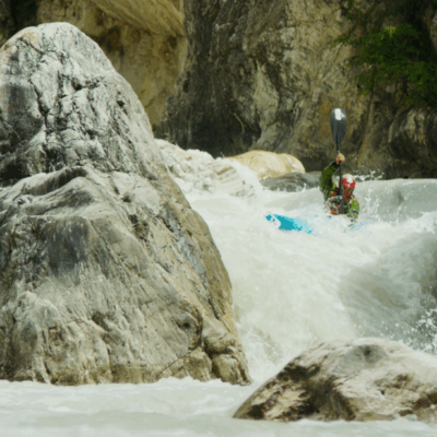
A must-see in the region, a passage through the mythical gorges of the Durance! The gorges are engaged and narrow, classified III-IV. Despite a few mandatory portages, the last rapids that follow one another are magical, for an unforgettable experience.
The Guisane
Bonus gift: Two possible sections on the emblematic river of the Serre-Chevalier valley, starting from Monêtier-les-Bains and Chantemerle. The first is classified II-III and is perfect for an introduction to alpine rivers, crossing several hamlets, in a calm way, except on the few rapids that add spice to the crossing. The second course is more technical, classified III-IV, punctuated by a few rapids without excessive difficulty.
Plan your routes online
Discover our website dedicated to hiking in the Écrins and prepare your next outing as well as possible!